
 49.0°,
Fair
49.0°,
Fair Latest from hurricane center: 10 to 20 percent chance Merrick-Bellmore will be hit by 8-foot surge
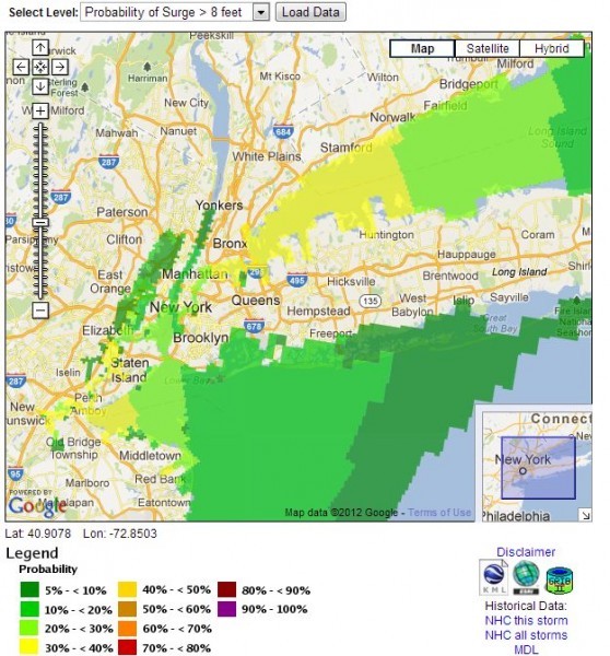
On Monday afternoon, the National Hurricane Center upgraded its risk assessment for south Merrick and south Bellmore, saying there was a 10 to 20 percent chance the area could be hit by a storm surge of at least eight feet.
A storm surge is different than the wave action caused by a hurricane. Surge is a steady rise in sea level itself, according to the National Oceanographic and Atmospheric Administration, which oversees the National Hurricane Center. So, an eight-foot storm surge would mean a sea level rise eight feet above normal levels.
Storm surge is a critical factor in determining whether water from the Atlantic will inundate an area. Many parts of Merrick and Bellmore south of Merrick Road lie at or only a few feet above sea level, so even a four-foot storm surge could cause street flooding in those sections of the community. And, during Monday's morning hide, a number of low-lying streets in south Merrick and south Bellmore were flooded, before waters receded.
The National Hurricane Center created an interactive Storm Surge Probabilities map to allow homeowners to help determine whether their community will be hit by flooding caused by Sandy’s massive surge. It can be found at http://www.nhc.noaa.gov/refresh/graphics_at3+shtml/153841.shtml?gm_psurge.


